 Trail Route Information:
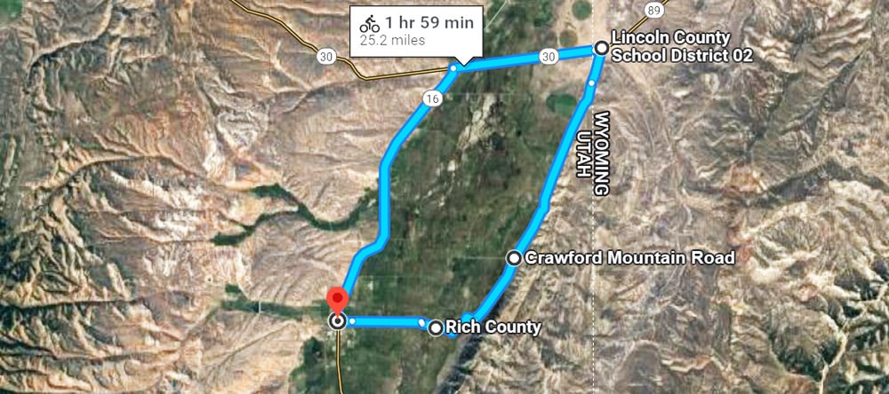
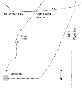
Park in Randolph and head north on Highway 16. Follow the road north, passing Crystal Spring on the way to Sagebrush Junction. This is where US 89/Highway 30 meet up with Highway 16. Make a right and follow 89/30 east into Wyoming. At the base of the Crawford mountains, make another right and follow the road along through the rolling foothills. Make a final right and head west to Randolph to complete the loop.
Features:
Note the numerous mine shafts along the east face of the Crawford Mountains.
Point of Departure:
Park in Randolph
Length:
24 mile loop
Season of Use:
Spring, Summer, Fall
Open to:
Bikes, horses
Difficulty:
Easy – Moderate
Address
549 Utah 16, Randolph, Utah 84064
GPS
41.669730434485, -111.18497437149