 Trail Information:
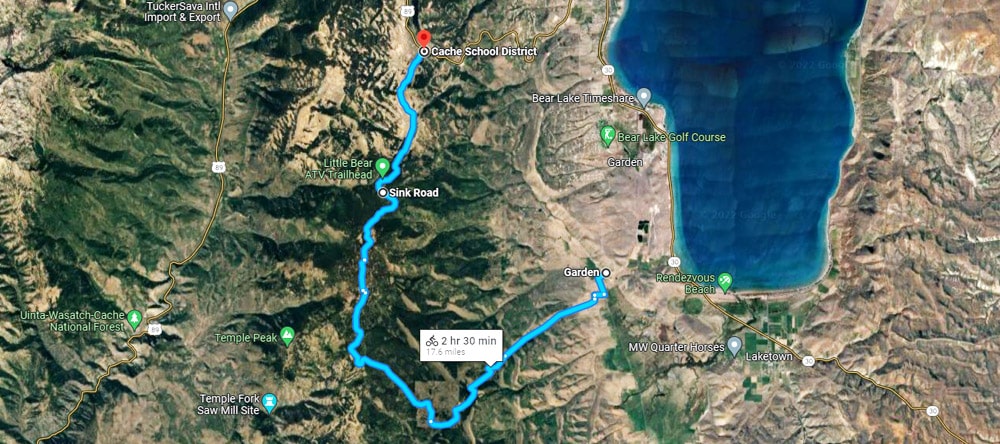
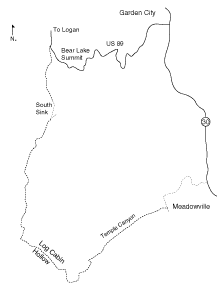
There are no facilities or safe drinking water on this ride; be sure to take plenty of water with you! If you ride from the summit to Meadowville, this is an easy to moderate ride. Parking is available both at the Bear Lake summit and in the community of Meadowville.
Features:
Watch out for motor vehicles and dusty conditions along this route. This route passes through mixed conifer forest and “The Sinks,” depressions in the landscape that are the result of the dissolving action of water on limestone. In the Sinks area, geologic factors have resulted in a unique phenomenon of abrupt and extreme temperature drops; the second-lowest temperature ever recorded in the lower 48 states was recorded here.
Trailhead:
Parking at Bear Lake Summit and in Meadowville
Elevation Range:
6000 – 8500 ft..
Length:
15.5 miles one way
Season of Use:
Mid-June to mid-October
Reference Maps:
Garden City, Meadowville
Open to:
Bikes, hiking, horses, licensed/registered motorcycles and ATVs
Difficulty:
Moderate – Difficult
Address
U.S. 89 Uinta-Wasatch-Cache National Forest, Garden City Utah 84028
GPS
41.942088701979, -111.40987007564